Analyze illumination, terrain, orbits, anomalies, and historic missions—all through one nimble, customizable platform built for serious scientific exploration.

Explore how the Moon transforms throughout its cycle. QuickMap turns complex illumination data into intuitive, visual insight.
Go to demo >>
Follow the LRO, KPLO, and other spacecraft along their orbits in real time or across mission history.
Go To Demo >>
Generate custom Keplerian orbits by providing a satellite’s position and velocity. A nimble, customizable tool that reflects ACT’s 30+ years helping missions pivot quickly and uncover insights efficiently.
Go to demo >>
Visualize south-polar illumination at any moment by blending high-resolution datasets.
Perfect for mission planning, concept studies, or anyone navigating the Moon’s most complex terrain.
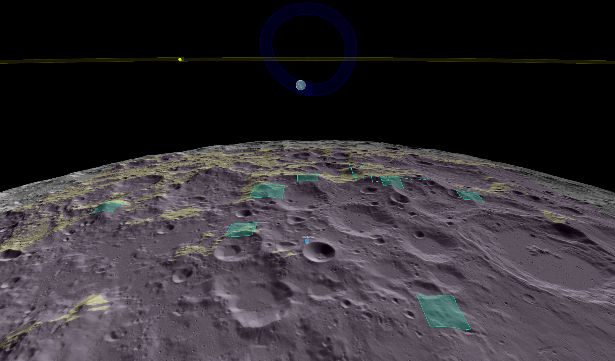
Dive into NASA’s Artemis III candidate landing regions with detailed terrain context, illumination patterns, and orbital geometry. Empowering researchers and mission planners to evaluate south-polar sites with clarity and confidence.
Go to demo >>
Transform raw illumination data into meaningful, actionable understanding. QuickMap provides tools that remove analytical roadblocks so you can focus on insight
Go To Demo >>
Evaluate potential lunar base locations using QuickMap’s geophysical layers or your own datasets.
Go to demo >>
Build custom expressions—like albedo ratios or terrain filters—and instantly visualize results.
Fast, flexible analysis.

Revisit one of humanity’s most iconic missions through high-resolution imagery, lighting controls, astronaut traverses, and 3D models.
Go to demo >>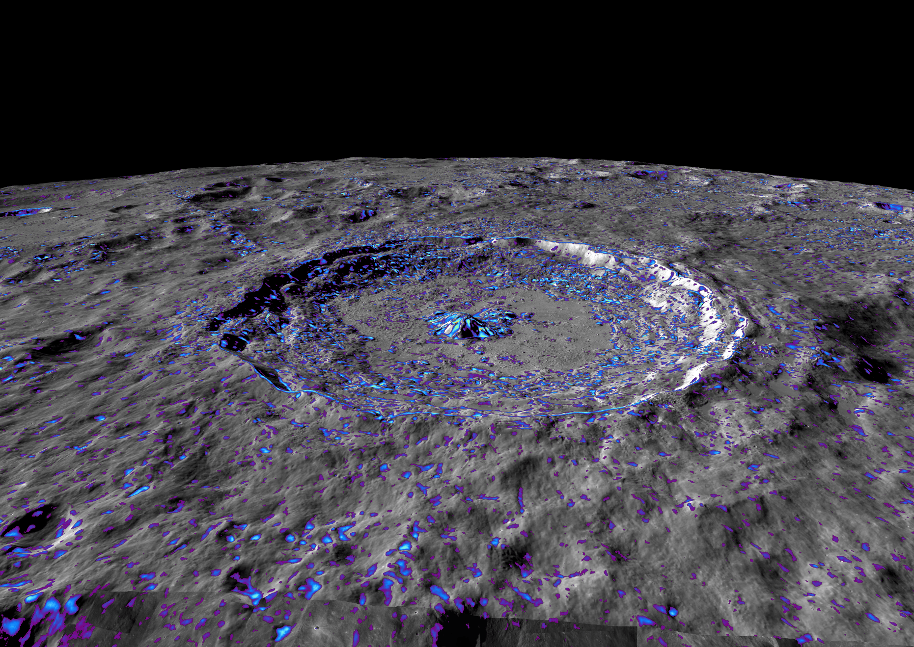
Evaluate differences between Digital Elevation Models to understand uncertainty and improve understanding.
Go To Demo >>
Quickly identify slopes that meet your safety, science, or operational requirements using intuitive controls.
Designed to help teams make confident terrain decisions—faster and more reliably.
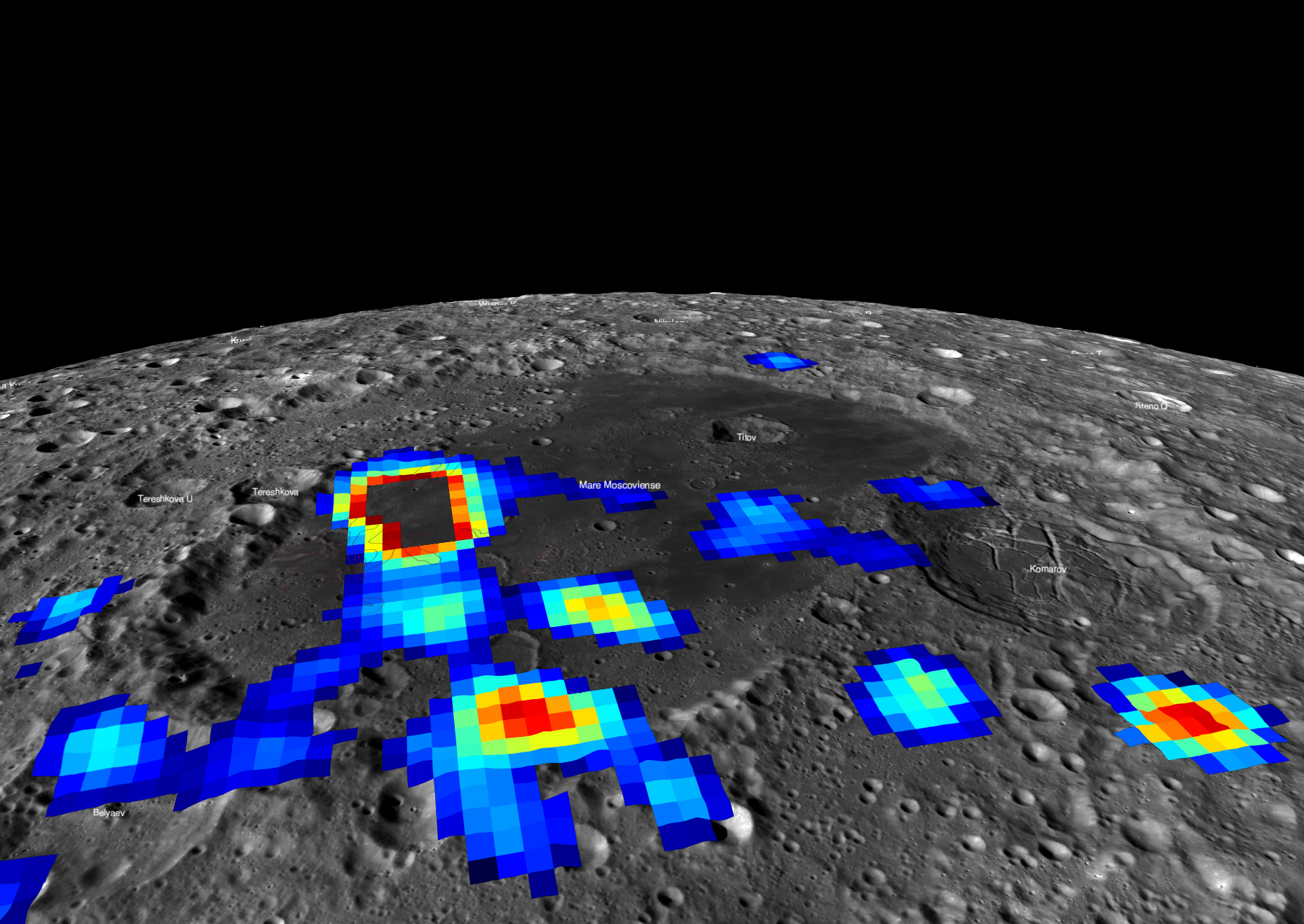
Explore newly integrated magnetic anomaly datasets and uncover patterns hidden beneath the Moon’s surface.
Innovative tools for innovative missions, built by a team dedicated to supporting your journey to discovery.